
Town story · Pulaski County · 1,232 people (2020 Census)
Dixon, Missouri Both Sides of the Tracks
Dixon, Missouri was laid out in 1869 on both sides of the Frisco tracks and named for Dixon, Illinois by the men who built the line. It still gathers around its schools, its library and park, and a September festival where someone wins a cow.
Seen a Dixon sign in Pulaski County? Send us the photo.
The Story
Dixon sits spread around the top of a rolling Ozark foothill in the northeast corner of Pulaski County, one mile south of the Maries County line. The headwaters of the north-flowing Maries River lie along the northwest edge of town, while streams on the south and east sides run toward the Gasconade River, about five miles to the southeast.1, 2
The town came with the railroad. The city's own history remembers a camp of about a hundred railroad workers just west of the present town in 1867 and 1868, after the Civil War, as the line pushed through Pulaski County. In 1869 Dixon was laid out when the railroad was built to this point, and a post office named Dixon has been listed ever since.1, 3, 4, 5
Its name travelled with the men who built the line. The State Historical Society's place-name file says railroad workers named the new town for their home town, Dixon, Illinois. The city history gives the surveyor's version: Frisco surveyor Milton Santee, himself from Dixon, Illinois, laid Dixon out on both sides of the tracks and suggested the name.3, 1
For its first years Dixon was more than a stop. In the 1870s William H. Harris built three hotels here for the railroad trade, and some of the earliest known views of Dixon show the Frisco's nine-stall roundhouse, turntable and coaling chute, the depot, and tracks on Dixon Hill. In 1883 the St. Louis and San Francisco Railroad moved its division point from Dixon to Newburg, and the Harris family followed the work to the new roundhouse there.6, 1
The trains never left. The railroad still runs through town, where the city says a midday whistle is a common sound, and Dixon remains a small trade and school town: home of the Dixon R-I Bulldogs, of the Jessie E. McCully Memorial Library beside Lions Club Park, and of the Cow Days festival that fills downtown each September.1, 7, 8, 9
Around Town
Downtown and the history murals
Downtown, around Second Street and Elm Street
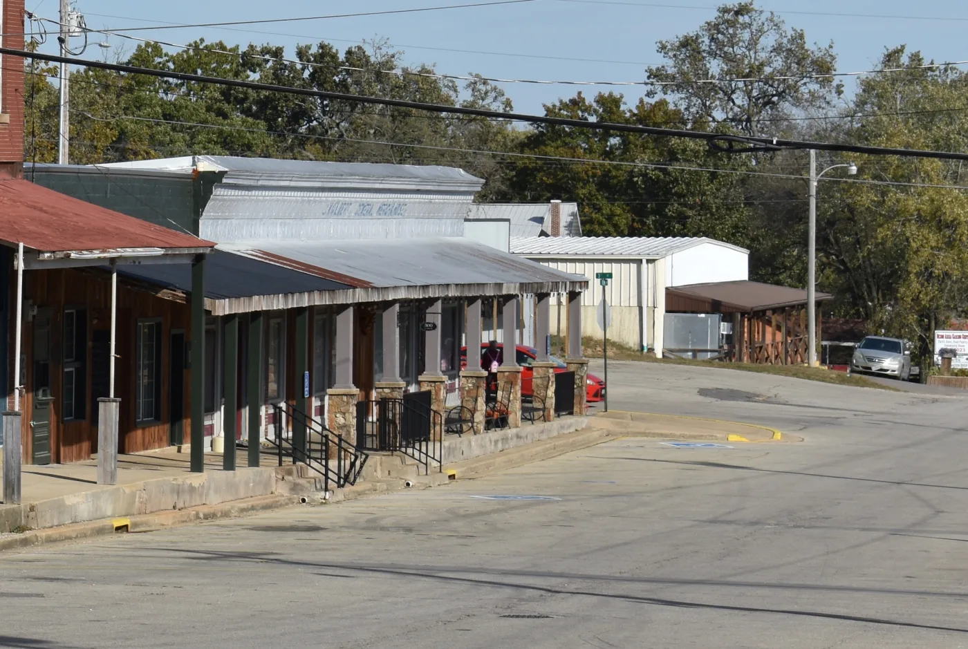
Walk the downtown sidewalks past the brick storefronts. The county visitor guide points walkers to murals depicting Dixon's history along the storefronts, and the Cow Days festival is centred at Second and Elm.9, 10
The railroad and Dixon Hill
The railroad through town; view only from public streets and crossings
Dixon was laid out on both sides of the tracks, and early stereoviews show the depot, roundhouse and tracks on Dixon Hill. Enjoy the trains from public ground and stay clear of the rails.1, 6
Jessie E. McCully Memorial Library and Lions Club Park
200 South Pine Street
The town library, nestled next to Dixon Lions Club Park, in the words of the city history. A good first stop for local notices and a sense of the town.8, 1
Dixon City Park
In Dixon; see the Pulaski County visitor listing for directions
The county visitor guide recommends time at Dixon City Park for a picnic and a walk along the trail.9
Olde Oak Station
300 South Elm Street
A multipurpose gathering place for reunions, weddings, parties and receptions, and home to an indoor vendor fair during Cow Days.1, 10
Oak Hills Country Club and the youth fields
North side of town
On the north side of town, the city history places Oak Hills Country Club and the Dixon Youth Recreation Association fields. The visitor guide likewise sends golfers to Oak Hills.1, 9
The Gasconade River, a short drive southeast
Jerome Access off the Route D bridge; Riddle Bridge Access at the end of Highway Y north of St. Robert
Dixon's streams run to the Gasconade, about five miles southeast of town. For a first look at the river itself, the conservation department describes bank access, parking and a concrete boat ramp at the Jerome Access, on the Phelps and Pulaski County stretch of the river.1, 11
If You Go
- Dixon is on Highway 28, about 13 miles north of Interstate 44. Highways 28 and 133 serve the community; check a current map for the last miles into town.9, 1
- Missouri Route 28 runs through Dixon at Chestnut Street, so expect ordinary highway work and flag crews from time to time. Check MoDOT before you travel.12
- The Jessie E. McCully Memorial Library, 200 South Pine Street, lists hours of Monday to Friday, 10:30 a.m. to 5:00 p.m. Confirm current hours before you go.8
- Cow Days fills downtown on the third weekend in September, centred at Second Street and Elm Street. Check the current year's dates and schedule before you travel.9, 10, 13
- Before floating or fishing the Gasconade, check that the access you plan to use is open. The conservation department warns that accesses can close for maintenance or flood damage.11
Sources
- City of Dixon, Missouri. About Dixon Missouri - History, Community, and Services. dixonmo.gov
- Wikipedia contributors. Dixon, Missouri. en.wikipedia.org
- The State Historical Society of Missouri, Missouri Place Names (Frank Weber, 1938). Pulaski County Place Names, 1928-1945. web.archive.org
- Jim Forte Postal History. Post Offices: Missouri, Pulaski County. postalhistory.com
- Pulaski County Tourism Bureau. Our Heritage. visitpulaskicounty.org
- The State Historical Society of Missouri. Newburg, Missouri Photograph Collection, circa 1870s-1910s (R1203). collections.shsmo.org
- Dixon R-I School District. Dixon R-I School District. dixonr1.com
- City of Dixon, Missouri. Dixon Library (Jessie E. McCully Memorial Library). dixonmo.gov
- Pulaski County Tourism Bureau. Dixon. visitpulaskicounty.org
- Pulaski County Tourism Bureau. September 2026 Events. visitpulaskicounty.org
- Missouri Department of Conservation. Gasconade River (Phelps/Pulaski County). mdc.mo.gov
- Missouri Department of Transportation. Planned Road Work for Mid-Missouri. modot.org
- Missouri Division of Tourism (Visit Missouri). Fall Festivals in Missouri. visitmo.com
- U.S. Geological Survey, Geographic Names Information System, feature 749667. GNIS record
- U.S. Census Bureau, 2020 Census, Redistricting Data (P.L. 94-171), table P1, place 29-19630.
See something wrong? Write to us and we'll fix it.